WELCOME TO ARBOLADA RESIDENTIAL DEVELOPMENT OPPORTUNITY
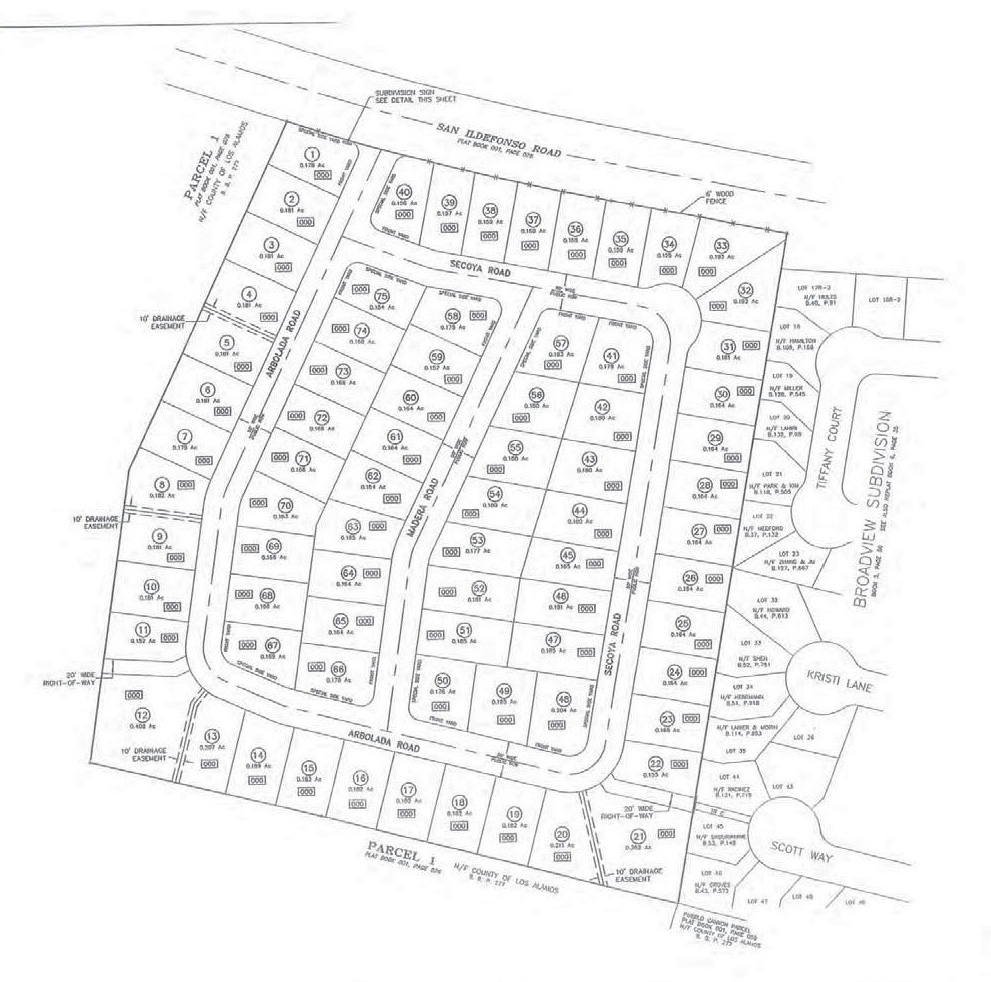
Arbolada is a 17.1-acre single tract of land in Los Alamos County, New Mexico (the “Property”). An unrecorded Preliminary Plan and Plat was prepared for the seller’s predecessor in 2007 (the “Preliminary Plat”). The Preliminary Plat indicates that the Property may be developed by its purchaser. A copy of the Preliminary Plat will be assigned to the buyer and provided to the buyer for review during the buyer’s due diligence period.
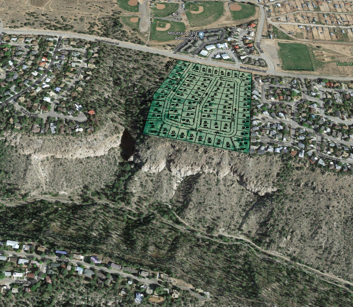
The Property lies between the Broadview Estates development and Los Alamos County open space. Utilities run adjacent to the northern boundary of the Property along San Ildefonso Road.
Arbolada is currently zoned PD-5. PD-5 zoning is considered a planned development residential district intended to accommodate varied developments of residential character with potential mixtures of single-family, two-family, and multiple-family dwellings. PD-5 indicates the maximum dwelling units per gross acre. Refer to the Los Alamos County Code of Ordinances for additional information.
PROPERTY OVERVIEW
Property Information
Property Amenities
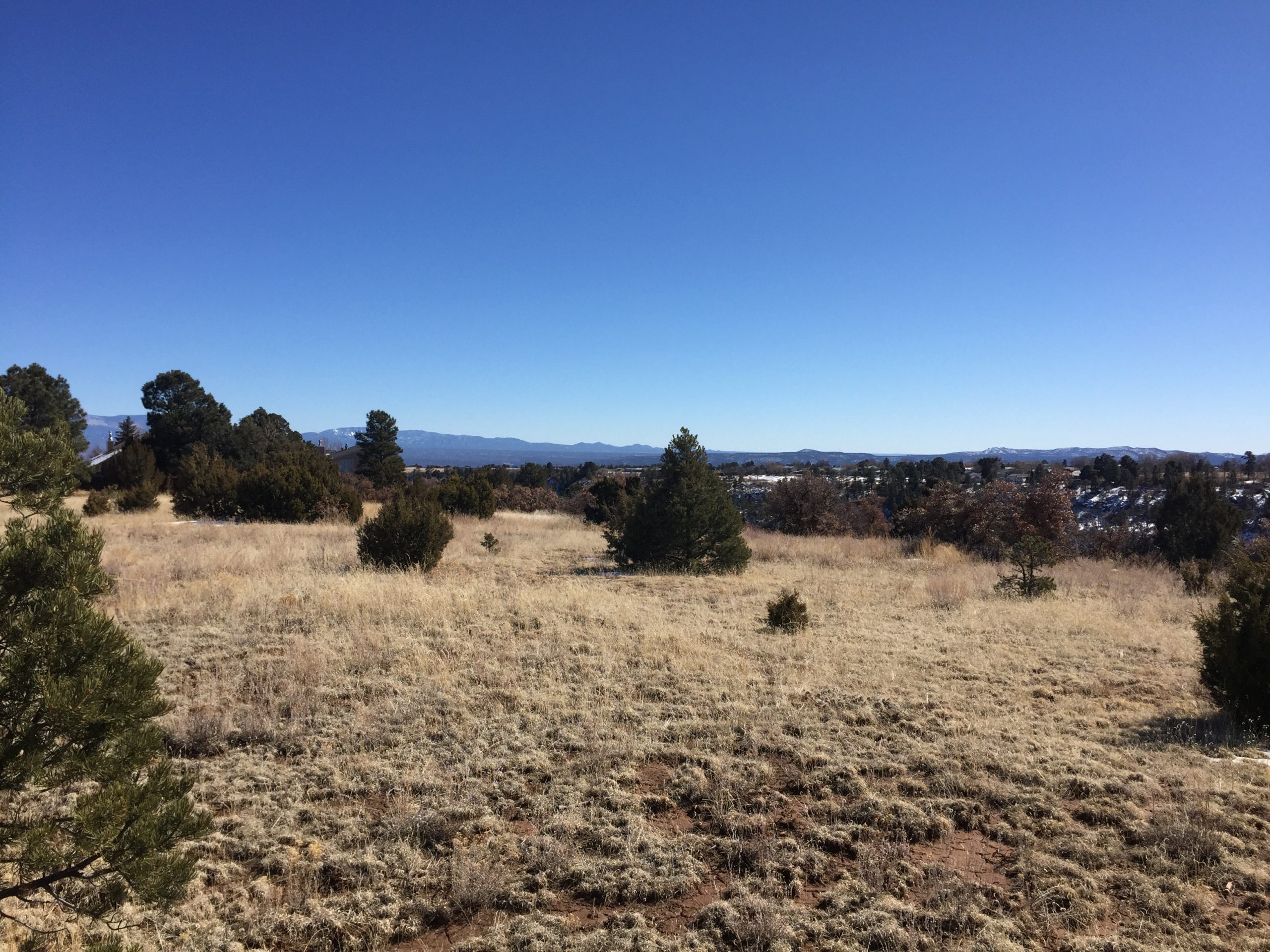
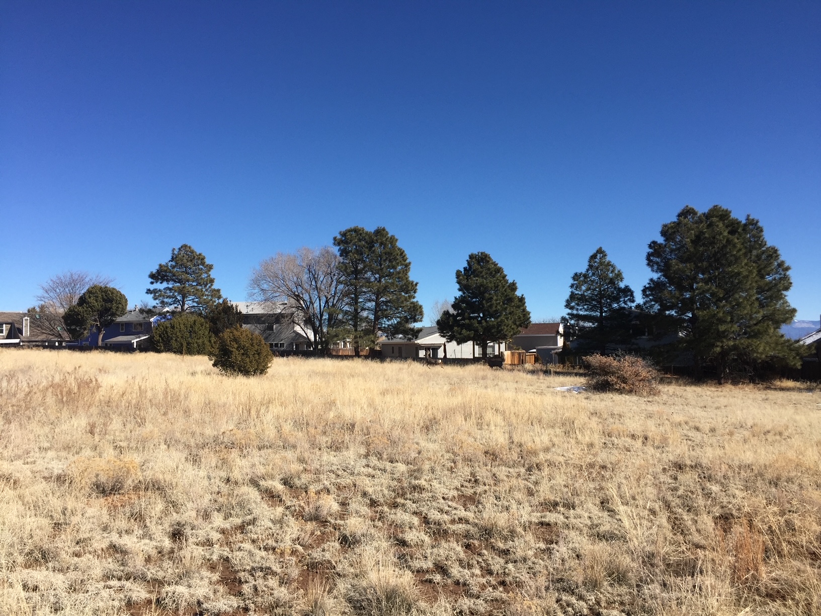
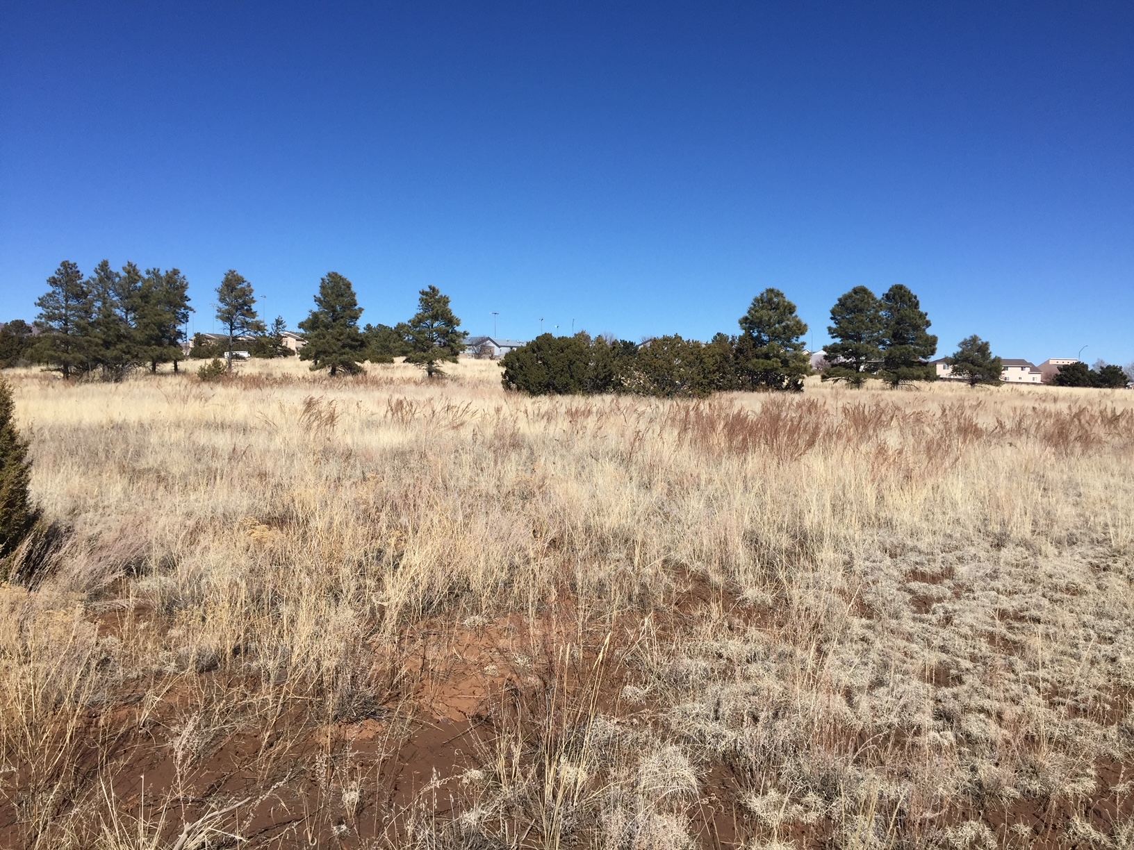
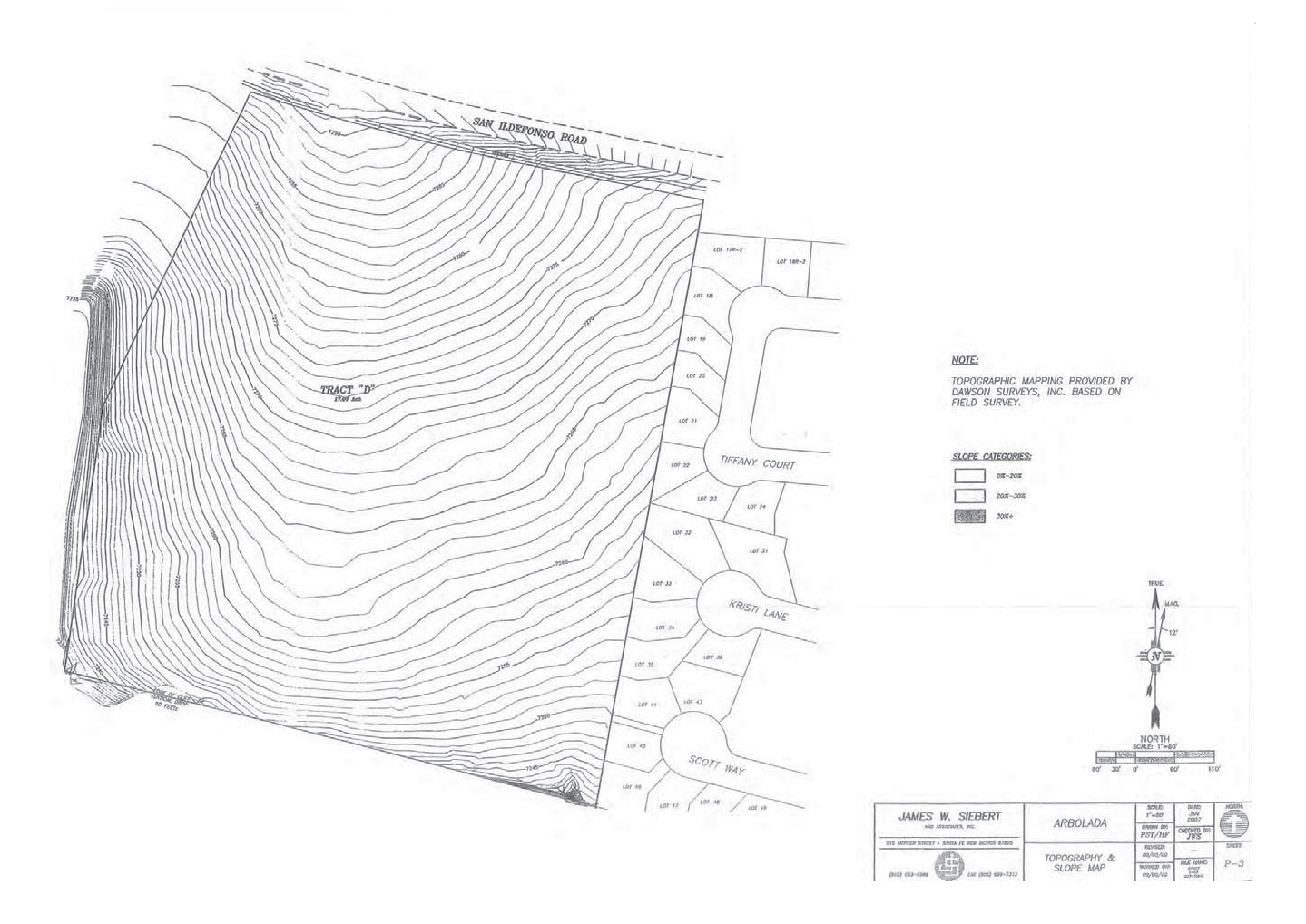
- Predominately flat land with little elevation change (~average slope of 0.06)
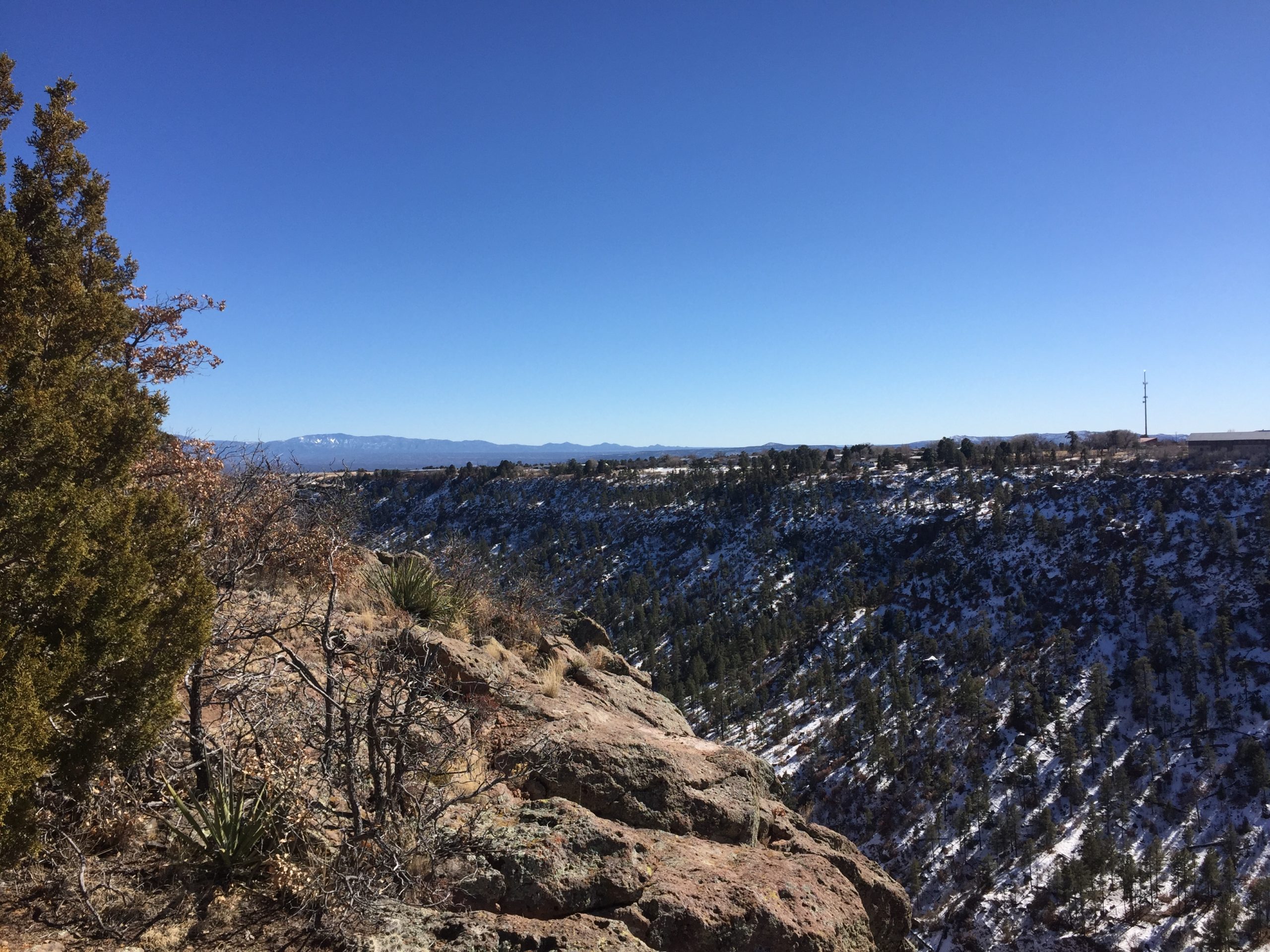
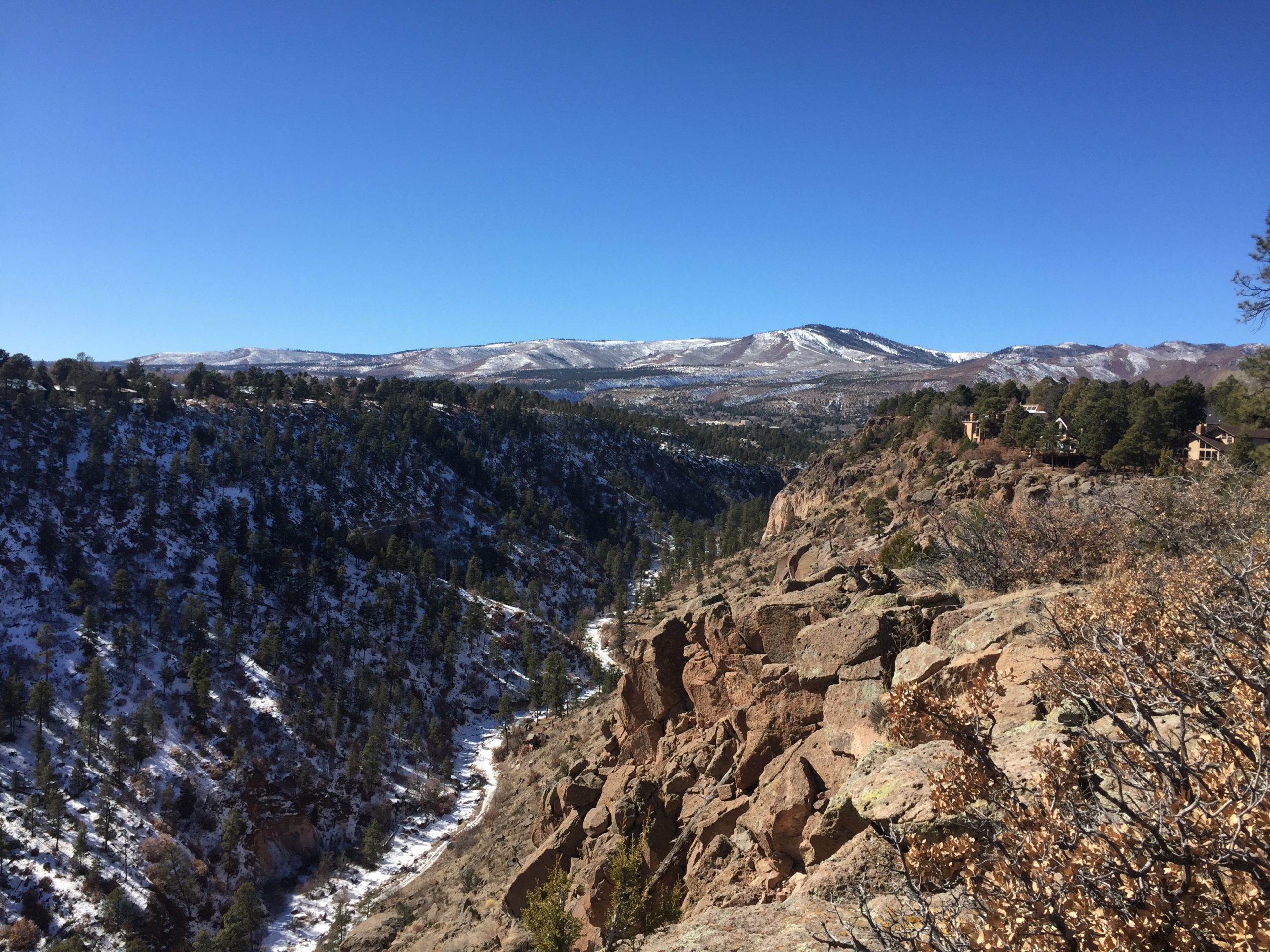
- Southern boundary of the Property borders a portion of Pueblo Canyon and offers extraordinary views
- Utilities run in the vicinity of the northern boundary of the Property along San Ildefonso Road
- Approximately 5 miles to downtown Los Alamos and 40 miles to downtown Sante Fe
- Mature trees on west boundary of Property
Plat and Property
Property Elevation
The topography from 2007 shows that the Property gently slopes from north to south from an elevation of 7290 feet to 7240 feet. According to the 2007 Preliminary Plat, the southern boundary of the Property has an average elevation of 7250. The Property offers exceptional views of both the Jemez Mountains to the west and the Sangre de Cristo Mountains to the east. The western boundary of the Property borders a small wooded canyon that is currently owned by Los Alamos County and serves as open space.
The Sellers make no representations or warranties that the Property may be developed pursuant to the Preliminary Plat below or otherwise. The Preliminary Plat is provided for informational purposes only and shall not be relied on by the Buyer as a representation or proposal of how, or whether, the Property may be subdivided into multiple lots. Buyer agrees and acknowledges that the Property is a single tract of land and Buyer must perform their own due diligence to determine whether the Property may be developed or subdivided.
To view the Preliminary Plat, click here.
LOS ALAMOS, NM
A High-Tech Mountain Community
Information derived from the “Comprehensive Plan Los Alamos County 2016”
The Incorporated County of Los Alamos is located in north central New Mexico, approximately 35 miles northwest of Santa Fe. The County is the home of Los Alamos National Laboratory, which is the County’s major employer. Not surprisingly, education levels are high in Los Alamos, where 64.3% of residents aged 25 and up have a bachelor’s degree or higher. The median household income has increased steadily since 2000, with a 2017 median household income of over $110,000. The estimated 2017 population in the County is 18,031, and the estimated 2018 population is 19,101.
Los Alamos county borders Bandelier National Monument, and the Santa Fe National Forest. It is home to the Manhattan Project National Historic Park and is adjacent to the Valles Caldera National Preserve. Los Alamos sits between the historic art communities of Santa Fe, NM and Taos, NM.
Hiking, fishing, rock climbing and cross-country skiing opportunities abound both within and around Los Alamos. 5 miles west of Los Alamos is Pajarito Mountain Ski Area. Pajarito offers 300 acres of skiable terrain with 5 lifts providing over 1400 vertical feet of runs. This historic and beautiful southern Rocky Mountain skiing opportunity was originally founded by the scientists of the Manhattan Project.
Los Alamos Public Schools serves the community and is ranked the #1 school district in New Mexico.
Arbolada Land

Disclaimer
All materials and information received or derived from Sellers, or, without limitation, their agents, advisors, managers, representatives, contractors, attorneys, property manager, affiliates and/or any third party sources (collectively, “Seller Parties”) are provided without representation or warranty as to completeness , veracity, or accuracy, condition of the Property, compliance or lack of compliance with applicable governmental requirements, ability to develop or suitability, financial performance of the Property, projected financial performance of the Property for any party’s intended use or any and all other matters. Neither Sellers nor the Seller Parties, make any guaranties, representation or warranty of any kind or character, express or implied, statutory, oral or written, past, present, or future as to accuracy or completeness of the materials or information provided, derived, or received or in respect to the Property, including, without limitation, the following, whether patent or latent: (i) matters of title; (ii) environmental matters relating to the Property or any portion thereof; (iii) geological conditions, including, without limitation, subsidence, subsurface conditions, water table, underground water reservoirs, limitations regarding the withdrawal of water and earthquake faults and the resulting damage of past and/or future earthquakes; (iv) whether, and to the extent to which the Property or any portion thereof is affected by any stream (surface or underground), body of water, flood prone area, flood plain, floodway or special flood hazard, (v) drainage, (vi) soil conditions, including the existence of instability, past soil repairs, soil additions or conditions of soil fill, or susceptibility to landslides; (vii) zoning and public or private land use restrictions or covenants to which the Property or any portion thereof may be subject which are contained in public records, (viii) the availability of any utilities to the Property or any portion thereof including, without limitation, water, sewer gas and electric, (ix) usages of adjoining properties, (x) public access to the Property or any portion thereof, (xi) the value, size, location, use, quality, description, habitability, suitability, operation, or physical or financial condition of the Property or any portion thereof; (xii) the presence of Hazardous Substances (hereinafter defined) in or on, under or in the vicinity of the Property; (xiii) the condition or use of the Property or compliance of the Property with any or all past, present or future federal, state or local ordinances, rules, regulations or laws, building, fire or zoning ordinances, codes or other similar laws, including, without limitation, the Americans with Disabilities Act, or any other statute, law, ordinance, code, rule, or regulation; (xiv) the current or past existence or non-existence of underground storage tanks; (xv) the potential for further development of the Property; (xvi) the existence of land use, zoning or building entitlements affecting the Property; or (xvii) the habitability, merchantability, or suitability of the Property or fitness of the Property for any particular purpose (Buyer affirming that Buyer has not relied on the skill or judgment of any of the Seller Parties to select or furnish the Property for any particular purpose, and that Seller makes no warranty that the Property is fit for any particular purpose). Materials and information from the Seller, Seller Parties, or any source, whether written or verbal, that may be furnished for review shall not substitute for a party’s active conduct of its own due diligence and investigation into the Property and its conditions to determine these and other matters of significance to such party. Sellers will not investigate or verify any such matters or conduct due diligence for a party unless otherwise agreed in writing. EACH PARTY SHALL CONDUCT ITS OWN INDEPENDENT INVESTIGATION AND DUE DILIGENCE INTO THE CONDITION OF THE PROPERTY AND WHETER IT WILL SUIT THE BUYER’S INTENDED USE AND PURPOSES. Any party contemplating or under contract or in escrow for a transaction is urged to verify all information and to conduct their own inspections and investigations including through appropriate third-party independent professionals selected by such party. All financial data should be verified by the party including by obtaining and reading applicable documents and reports and consulting appropriate independent professionals. Sellers make no warranties and/or representations regarding the veracity, completeness, or relevance of any financial data or assumptions. Sellers do not serve as a financial advisor to any party regarding any proposed transaction. All data and assumptions regarding financial performance, including that used for financial modeling purposes, may differ from actual data or performance. Any estimates of market sales and/or projected sales that may be provided to a party do not necessarily mean that sales can be established at or increased to that level. Parties must evaluate any applicable contractual and governmental requirements and limitations as well as market conditions and other issues in order to determine sales for the Property. Legal questions should be discussed by the party with an attorney. Tax questions should be discussed by the party with a certified public accountant or tax attorney. Title questions should be discussed by the party with a title officer or attorney. Questions regarding the condition of the Property and whether the Property complies with applicable governmental requirements should be discussed by the party with appropriate engineers, architects, contractors, other consultants and governmental agencies.

